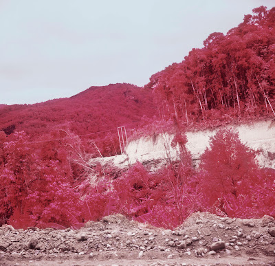
I finally got those films developed *one day* before the thesis kick-off meeting on the 19th, Jan, 2012.
MAG bomb clearance site, Xiang Khouang, Laos
Foreground: rice paddy field in dry season when farmers are not growing rice on site, but rather growing vegetables in the gardens near by. Yellow sticks in the field indicate where the MAG team has found the UXO, which will be destroyed at 3 pm everyday.
Background: spots of vegetation over the hill indicate where the bomb craters are - four decades after the bombing ended, the bomb craters have changed from symbols of death into ones of life - most of them are now covered with trees or shrubs. White patches over the hill indicate the clearings local people made to trap swallows, which is a special food Xieng Khouang is famous for.
MAG bomb clearance site, Xiang Khouang, Laos
Her name is Vienglada, Deputy Team Leader of UCT13, MAG.
MAG bomb clearance site, Xiang Khouang, Laos
The clearance site has been used as rice paddy field for more than 30 years. The owners of the land grow rice on site in raining season. They know there are UXO, and they found scrap metal on site all the time, but they have no choice other than keep farming.
The clearance site is around 4 hectar. The operation started on 28/12/2011. I got there on the 5th of Jan, by then, the team found and destroyed 79 BLU UXO. One day before I got there, they found a 500 lb big bomb.
The clearance site is around 4 hectar. The operation started on 28/12/2011. I got there on the 5th of Jan, by then, the team found and destroyed 79 BLU UXO. One day before I got there, they found a 500 lb big bomb.
Small trees in a big bomb crater, Xieng Khouang, Laos
Trees growing inside the bomb craters over the hill, Xieng Khouang, Laos
Vegetations growing inside a bomb crater, Xieng Khouang, Laos
Trees growing inside the bomb craters over the hill, Xieng Khouang, Laos
View from the air, Xieng Khouang, Laos
View from the air, Xieng Khouang, Laos
Mekong River in dry season, Vientiane, Laos
With trees growing on the other side of the Mekong bank (Thailand) in the background
View from the air, near Vientiane, Laos
View from the air, near Vientiane, Laos
View from the air, near Xieng Khouang, Laos
Roads in the mountain leading to the construction site of Nam Ngiep II Dam project, Xieng Khouang, Laos
10.9km of roads are newly created as part of the infrastructure setting up for the Nam Ngiep II Dam
Nam Ngiep River on the Nam Ngiep II Dam construction site, Xieng Khouang, Laos
Nam Ngiep II Dam construction site, Xieng Khouang, Laos
Trees are being cleared on the slope
Nam Ngiep II Dam construction site, Xieng Khouang, Laos
Nam Ngiep river is shown in blue in the center of the image
Roads in the mountain leading to the construction site of Nam Ngiep II Dam project, Xieng Khouang, Laos


No comments:
Post a Comment